Meeting the Past, the submerged constructions
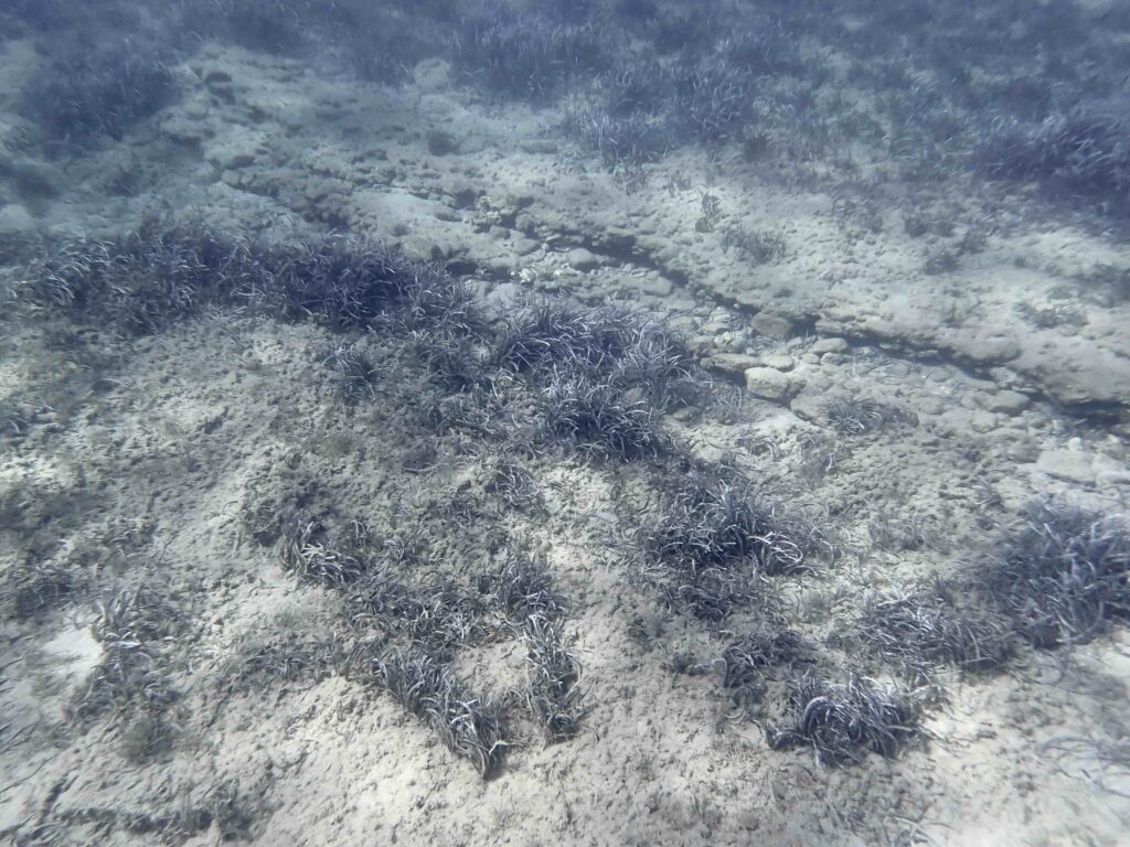
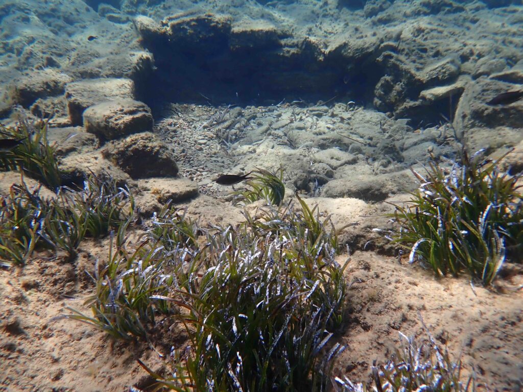
The ancient constructions I observed occur on the sea floor between Antiparos (Agios Georgios) and Despotiko at depths ranging from 1,5 to 3,5 meters (seemingly, for some of them, up to 5 m or more).  The relative sea-level was thus lower at the time they were built. They are a long straight wall, a sort of opened duct / channel, a high cylindrical wall recalling the shape of a well, several lower circular or higher square constructions bordered by uncemented stones, some of them recalling cist graves (see pictures below).

 Meeting such ancient constructions is questioning … what could be their ages and the time they were submerged?

These submerged constructions are known from previous observations. Bent (1884) by using a sort of can with a glass bottom (from a sponge fisherman) reports the presence of an oven and a small square house, while Morrison (1968) observes cyst graves of Early Bronze Age, a well-head and an oven of unknown age. According to Morrison (1968), these constructions are archaeological indicators of a relative sea level rise (RSL) of at least 3 m since the Early Bronze Age and probably of 5 to 6 meters RSL rise since the Neolithic.

There are a lot of publications dealing with sea-level rises and dating in the Aegean Sea but published estimates of these events can vary greatly (Lambeck 1995, 1996). In a survey of archaeological indicators, Baika (2008) suggests that in the Attico-Cycladic massif, the Neolithic and the Mycenean sea-levels were respectively ca. 6 m and 3 m below the present one, with an eustatic rise of ca. 1 m/1000 years (1mm/year) over the last 6000 years. An average subsidence rate of ca.1 +/- 0.4 mm /year since 5500 cal. BP is reported in Paros by Karkani et al. (2019), but this rate is not linear during the Late Holocene and have increased since 2500 BP. Seismic events (earthquakes, tsunamis) impacted the subsidence trend and shorelines in the Central Cyclades since at least 3300 BP (Evelpidou et al. 2014, 2018, Karkani et al. 2018, 2019, Galanidou et al. 2020).

Re-calibration of previously published data and new data were recently compared showing that sea-level rise is remarkably consistent among Cyclades (island group of Mykonos, Delos and Rheneia and the northern and Central Cyclades) (Kolaiti & Mourtzas 2023; Mourtzas & Kolaiti 2024). These authors observe five relative sea-levels (RSL) with an average rate of 0.76 mm/year since the Late Holocene. The five RSL respectively stand at -4.80 +/- 0.10 m (4300 BC - 1972 BC), at -3.70  +/- 0.20 m (1972 BC - 130 BC), at -2.40  +/- 0.25 m (130 BC - AD 1272), at -1.55  +/-  0.25 m (AD 1272 - AD 1650), at 0.80  +/-  0.10 m (AD 1650 - AD 1861). The sea-levels refer to depths below biological mean sea level (bmsl).

The depths of the submerged constructions between Antiparos (Agios Georgios) and Despotiko may fit several of these levels, but they require further scientific studies (identification and dating) to serve as archeological indicators of ancient sea levels.  One must also keep in mind that some constructions may be of different ages even when occurring at the same depth (‘diachronism’) … and this adds some complexity to date sea levels! In this precise area, isobaths suggest that an isthmus was linking Despotiko, Kimitri and Antiparos until at least the Hellenistic period (Draganits, 2009).
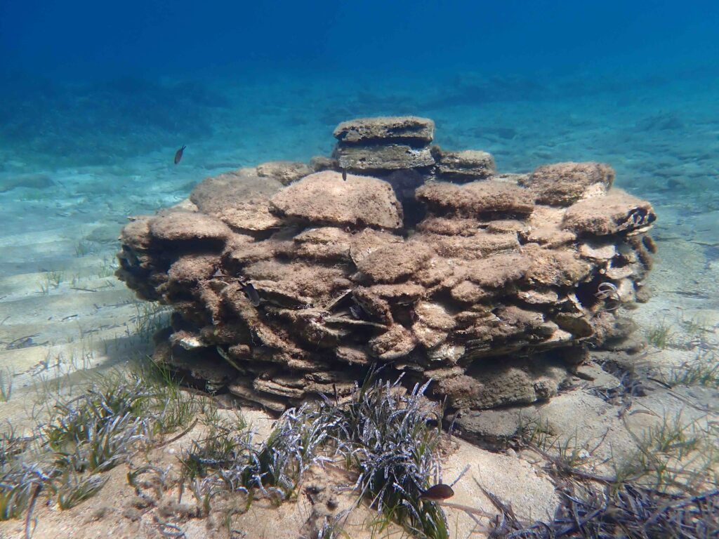
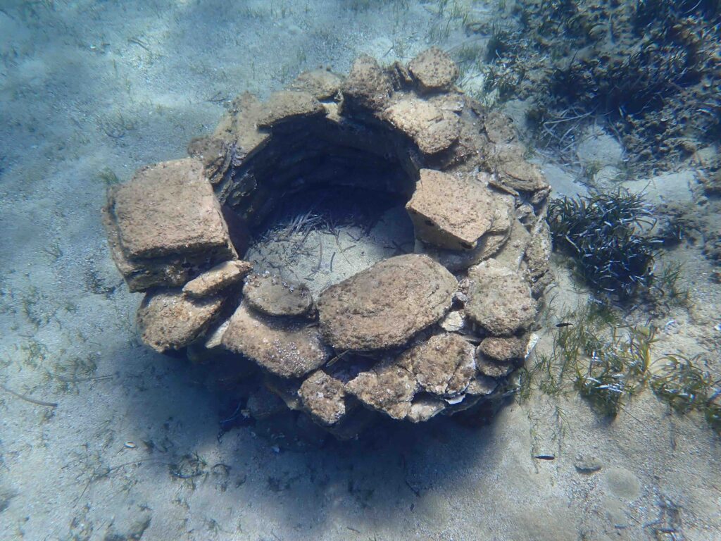
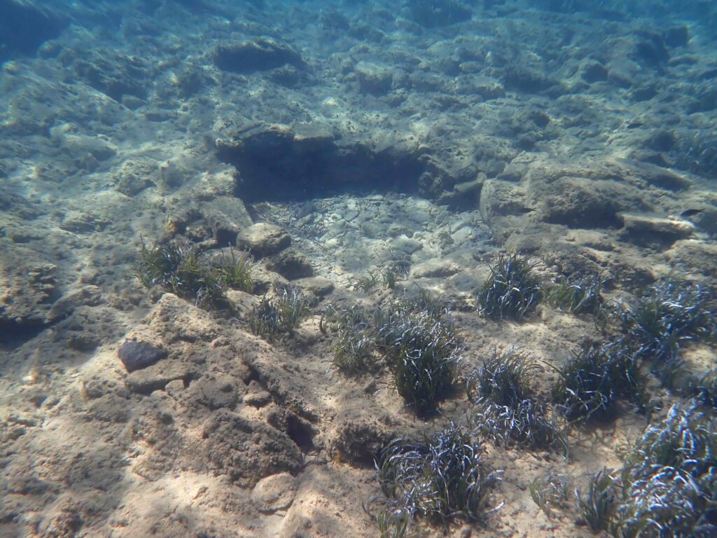
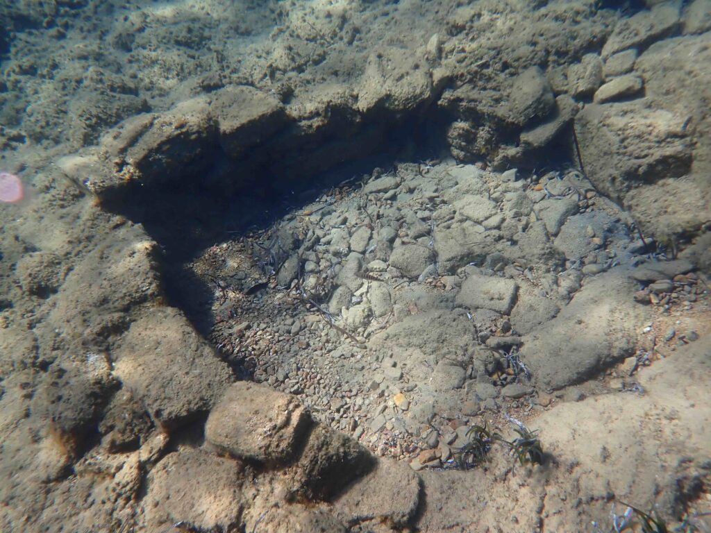
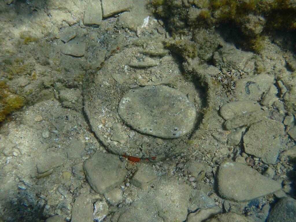
1. Cylindrical wall
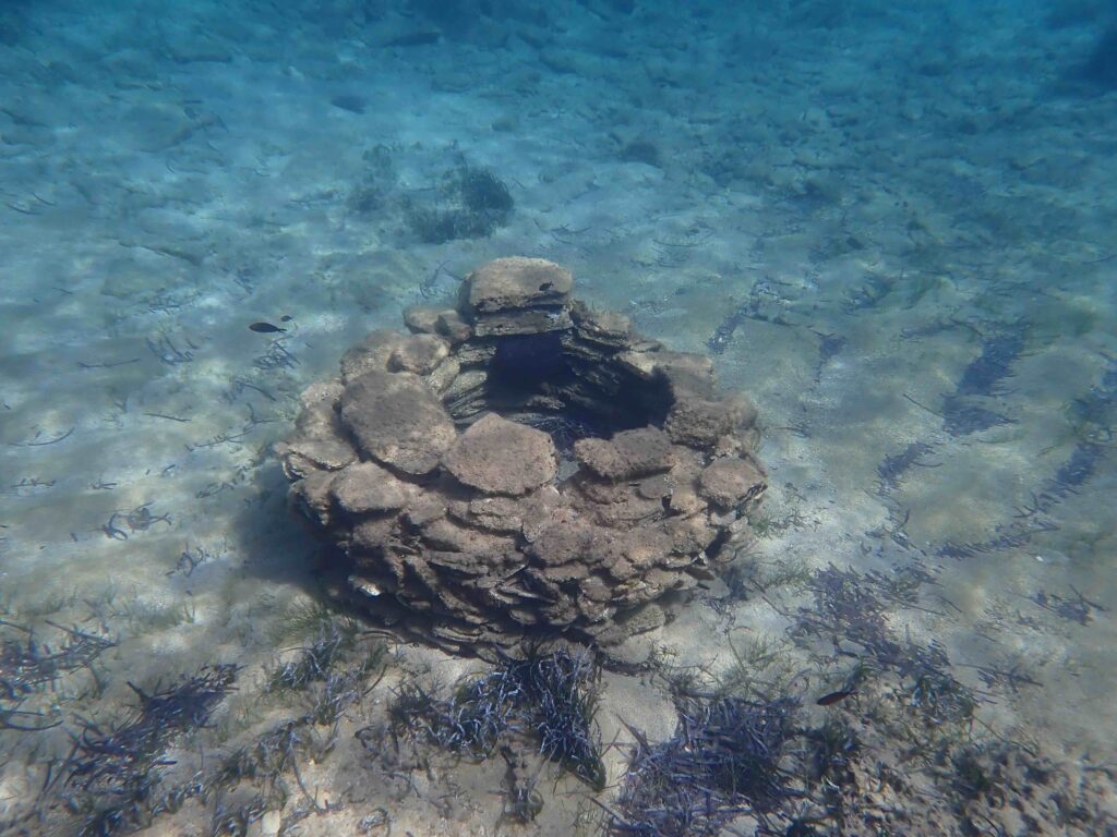
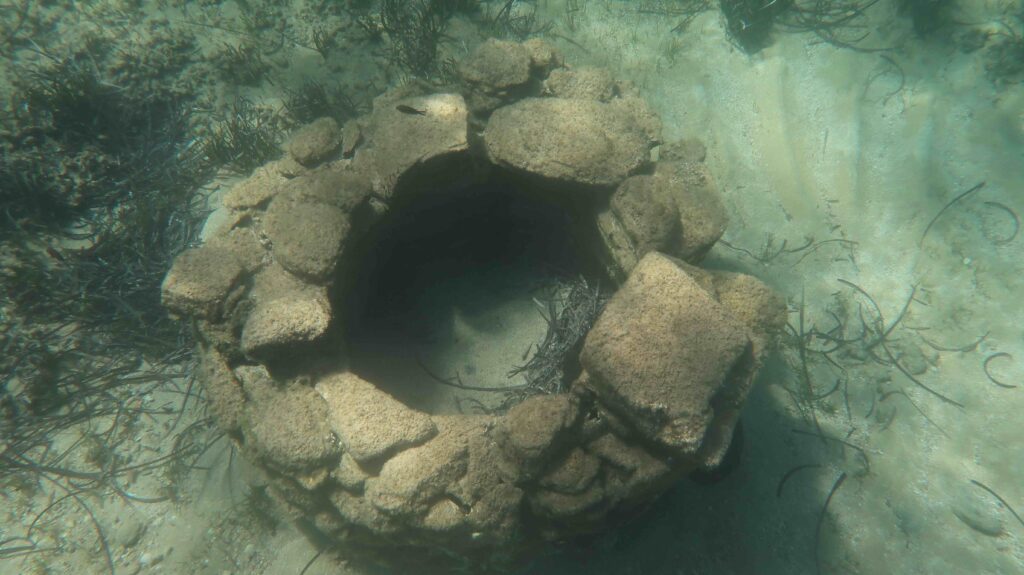
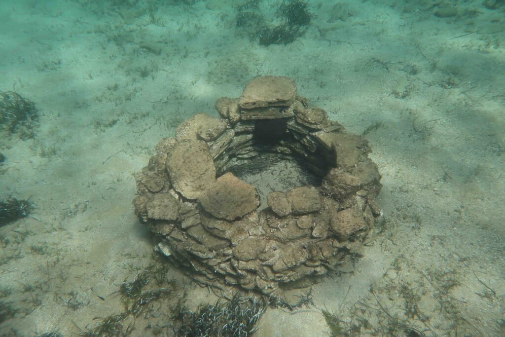
The construction is about 1.20 m in diameter and 60-70 cm high, located at 2 – 2.5 m depth... It was already observed by James Theodore Bent in 1884, using a sort of can with a glass bottom (from a sponge fisherman) ... thank you David F.W. for the reference!
It could be a remain of a water well or reservoir, or a particular place where a fire was kept (sort of small lighthouse) to indicate a particular site or passage?
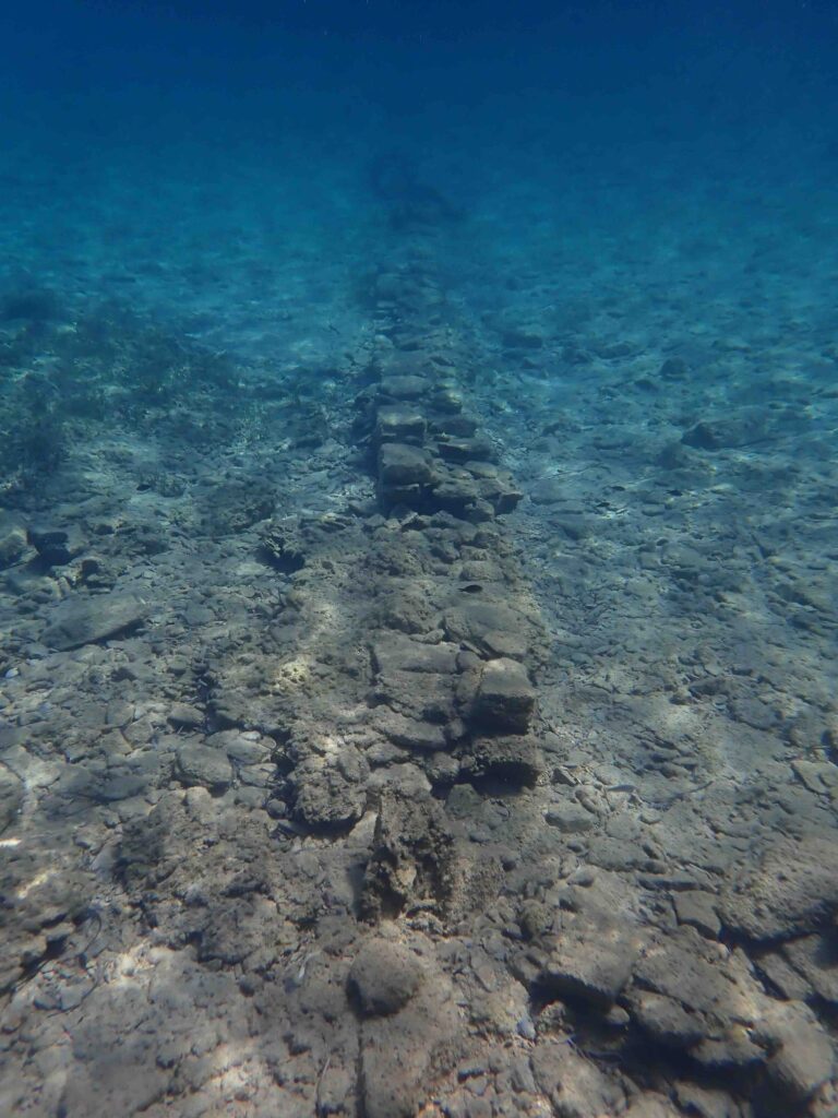
2. Straight walls
One straight wall 'intact' is orientated towards Despotiko. Several remains of damaged straight walls are dispersed in the vicinity.
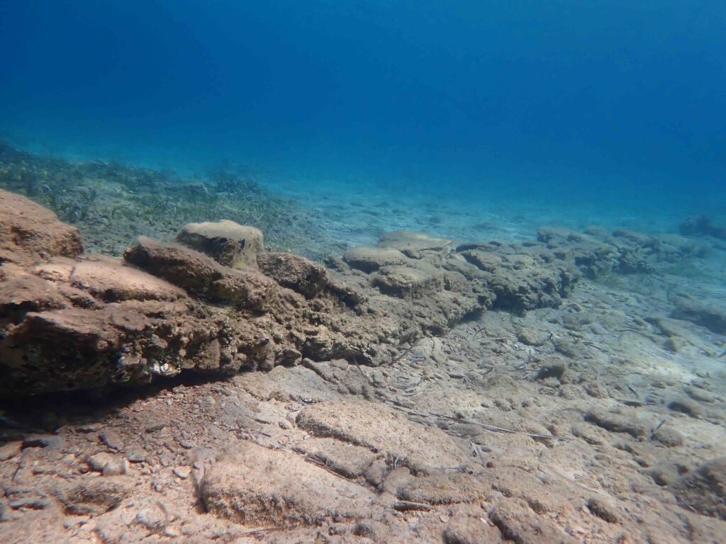
Did this wall simply delimit land (like those of today on the island)?
Is it located along an ancient road/path/passage, for example, along the isthmus that connected Despotiko, Tsimintiri, and Antiparos?
The intact wall seems also to be aligned with a valley on Antiparos… did it border a river?
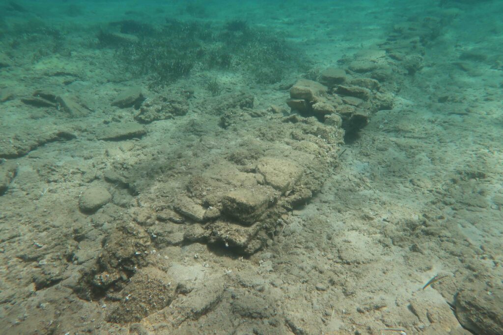
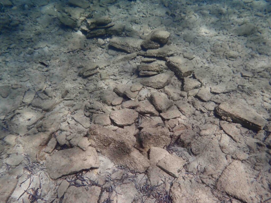
3. Opened ducts – channels
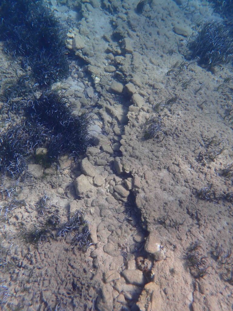
Is this structure an opened canalisation ? Edges seemingly collapsed but the bottom of the channel and its edge are still visible. It seems to have the same orientation than the straight intact wall.
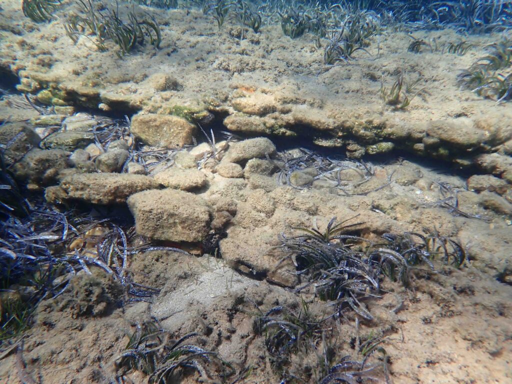
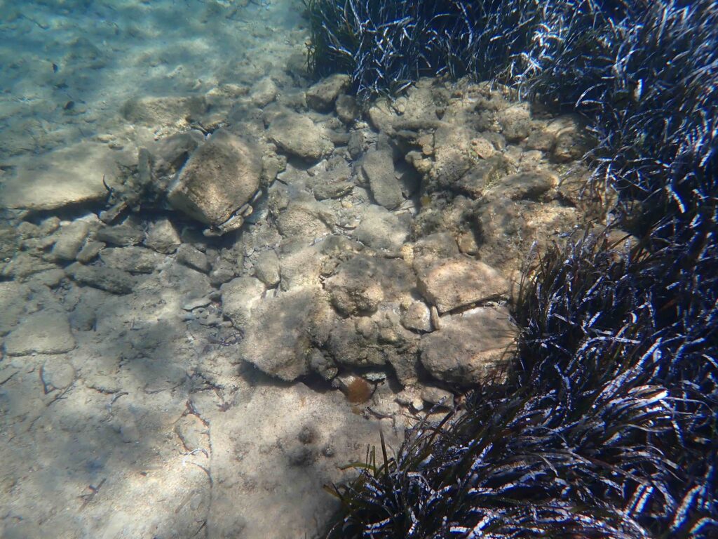
4. Bases of square or circular constructions
The three pictures illustrated the same construction (square structure, side length: ca. 1m, at 1.5-2 m depth ). It recalls the small square house reported by J.T. Bent in 1885…
There are other constructions that could be remains of small houses or of graves or…?
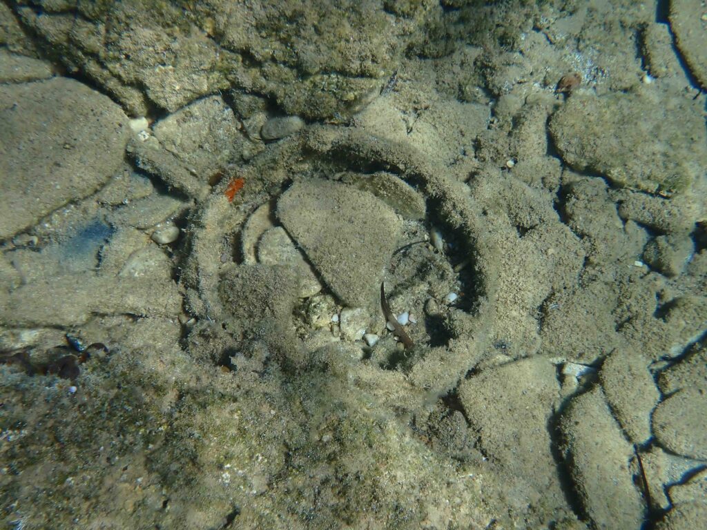
In the two above pictures, the diameter of the circular structure is ca. 60 cm
USEFUL NOTES…

1. Timeline points

Neolithic: 7000 - 3200 BC
Bronze Age: 3200 – 1100 BC
	Early Bronze Age: 3200 - 2000 BC
	Mycenean period (end of Bronze Age):  1500 - 1200 /1100 BC
Hellenistic period: 323 – 31 BC
(It is one of the periods of the Ancient Greece/Greek antiquity (1200 BC – AD 600)
https://en.wikipedia.org/wiki/History_of_Greece


2. ‘Tectonic background’- The Mediterranean Sea and the Aegean Sea

The Mediterranean Sea is the remnant of an ancient ocean, the Tethys, located between the two supercontinents Laurasia and Gondwana during the Mesozoic. From the Cretaceous period onwards, subduction between the African and Eurasian continents gradually closed the Tethys leading to the formation of the Mediterranean Sea. Then, about 6 million years ago (end of Miocene), the Strait of Gibraltar progressively closes and the Mediterranean dried consequently to its isolation from the Atlantic. This episode lasted for about 600,000 years (Messinian Salinity Crisis, Late Miocene). The next episode was the re-opening of the Strait of Gibraltar, occurring ca. 5.3 million years ago (Miocene/Pliocene transition).  This opening allowed the filling of the Mediterranean by massive cascades of water from the Atlantic. Today the African plate continues its movement towards the Eurasian plate causing earthquakes and volcanic activity.

In the oriental basin of the Mediterranean Sea, the Aegean Sea (with its 3500 islands) is located on the Aegean plate bordered by the European/Eurasian, the Anatolian and the African plates. Due to the active subduction of the African plate that moves under the Aegean plate, this latter undergoes regional uplift or subsidence, with series of extensive faults where earthquakes and volcanism are particularly intense. These tectonic and seismic activities together affected the absolute eustatic sea-level and are responsible for relative sea-level variations at regional scales. Consequently, the ‘sea-level story’ in the Aegean Sea is rather complex to decipher (see e.g., Jolivet et al. 2014, Galanidou et al. 2020).

3. What’s behind sea-level changes?

Sea-level changes result from to two main series of events: (1) changes in the volume of oceanic water (mainly resulting from glaciations / deglaciation events and from water temperature/density fluctuations) and (2) movements of the earth’s crust (seismic activity, plate tectonics) that may uplift lands or make them ‘sunken’ (subsidence) through isostasy.

Global sea-level rise refers to the average change in sea-level across the entire planet while relative sea-level is specific to a particular location; it is influenced by local or regional vertical movements of the Earth crust (subsidence or uplift), by volcanism and earthquakes, and by local sea currents; it may therefore differ from the global average sea-level.

Past sea-levels left traces. They are detectable via geomorphological and archaeological indicators. Moreover, some geological proxies as the age of sediments/rocks and fossils, radiometric measurements and the archaeological sites can allow dating sea-level changes.

Geomorphological indicators

 A combination of physical, chemical and biological processes shapes the coastlines. Coastal geomorphology may therefore have recorded past sea-levels.

Geomorphological indicators are erosion traces (e.g., tidal notches, sea caves, potholes, tafoni etc…) and deposition events (e.g., marine terraces, beachrocks) (see e.g., Evelpidou, 2018).

Tidal notches are distinct horizontal grooves or undercuts found on rocky (mainly limestone) coastlines. They are primarily formed by a combination of wave action and biological/chemical erosion. Their position reflects the average height of the sea-level, and their shape informs on the hydrodynamics in a particular place.  Tidal notch can therefore provide insights into past sea-level changes, tectonic movements, and even erosive power of waves and biological activity in a particular location. Biological activity is due to eroding microorganisms (e.g., Cyanobacteria) that perforate the rock and to gastropods (limpets and chitons) that erode this fragilized rock with their radula (a kind of tong bearing teethes) consuming the microorganisms together with the biofilm.

Marine terraces are coastal geological formations, flat or gently sloping rock platforms, which have been shaped by marine erosion and raised above present-day sea-level. They are considered as ancient shorelines that emerged following changes in sea-level, or tectonic movements of the Earth's crust. They may reach a few km wide and when well preserved, be used as sea-level indicators.

Beachrock is a cemented sedimentary rock that typically forms in the intertidal zone, and therefore that is closely linked to sea-level fluctuations. Its cementation process relies on seawater (often mixed with groundwater) that percolates through beach sediments and precipitates minerals, cementing the sand and gravel into a solid rock. When the sea-level changes, the beachrock can be left exposed above or submerged below the waterline, providing a record of past sea-level positions.

NB: Tidal notches, marine terraces and beachrocks allow to put forward the importance of vertical movements due to local seismic activity. They were for instance studied in details in the Cyclades (see e.g., Evelpidou et al. 2013, Evelpidou et al. 2018, Evelpidou 2018, Galanidou et al. 2020).


Archaeological indicators

Archaeological indicators are submerged or uplifted remains of ancient constructions that can inform on past sea-level positions (see e.g., Morhange & Marriner, 2015, Evelpidou & Karkani, 2018, Galanidou et al. 2020).

They are grouped into to two main categories: (1) constructions that are not particularly related to the sea-level position as they could have been built at a certain distance from the sea and (2) constructions strictly depending on the sea-level (fish tanks, jetties, wharves, harbors, shipbuilding berths, etc…). The second category is most informative as the constructions were built at or near the level of the sea, usually requiring a specific water level. Here, zonation of fossils on the constructions can also inform on past sea-levels (by comparing them with today zonation).

A particular case concerns the coastal water wells. Water-table depths in ancient coastal wells can be indicator of past sea level because there is a direct relationship between modern water table and nearby sea level. The study of 64 coastal water wells on the Israelian coast, allowed to position sea-level for the first century AD up to 1300 AD (Sivan et al., 2004). NB: this has tickled my interest as what’s look as a submerged well occurs in Agios Georgios.


REFERENCES

Baika K., 2008. Archaeological indicators of relative sea-level changes in the Attico-Cycladic massif: preliminary results. Bul. Geol. Soc. Greece XLII/II: 33-48.

Bent J.T. 1884. Notes on Prehistoric remains in Antiparos. J. Anthrop. Inst. Great Britain and Ireland XIV (2): 134 – 141.

Draganits, E. 2009. The Archaic sanctuary on Despotiko Island (Cyclades): geological outline and lithological characterization of the building stones with their possible provenance. Austrian J. of Earth Sci., 102: 91-101.

Evans, J.D., Renfrew C. 1968. Excavations at Saliagos near Antiparos, Athens. British
School of Archaeology at Athens, London: Thames & Hudson.

Evelpidou, N. 2018. Geomorphology of sea level. In: Finkl, C., Makowski, C. (eds) Encyclopedia of Coastal Science. Encyclopedia of Earth Sciences Series. Springer, Cham. https://doi.org/10.1007/978-3-319-48657-4_384-1

Evelpidou, N.& A. Karkani, 2018. Archaeology and sea-level change. In: Finkl, C., Makowski, C. (eds) Encyclopedia of Coastal Science. Encyclopedia of Earth Sciences Series. Springer, Cham. https://doi.org/10.1007/978-3-319-48657-4_396-1

Evelpidou N., Melini D., Pirazzoli P.A., Vassilopoulos A. 2014. Evidence of repeated late Holocene rapid subsidence in the SE Cyclades (Greece) deduced from submerged notches. Int. J. Earth Sci., DOI.10.1007/s00531-013-0942-0

Evelpidou, N., Tziligkaki, E., & A.  Karkani. 2018. Submerged antiquities on Paros and Naxos islands, Aegean Sea, Greece. New evidence for the mean sea level during the late Bronze Age and the Roman period. Bul. Geol. Soc. Greece, 52 (1), 71–97. https://doi.org/10.12681/bgsg.

Galanidou N., Dellaporta K. & D. Sakellariou, 2020. Greece: unstable landscapes and underwater archaeology. In: G. Bailey et al. (eds.), The Archaeology of Europe’s Drowned Landscapes, Coastal Research Library 35, https://doi.org/10.1007/978-3-030-37367-2_19.

Jolivet L., Brun J.P., Meyer B., Prouteau G., Rouchy J.-M., & B. Scaillet 2014. Géodynamique méditerranéenne. Enseigner les Sciences de la Terre, Soc. Geol. de France, Vuibert ed., 232 p.

Karkani A., Evelpidou N., Giaime M., Marriner N., Maroukian H. & C. Morhange 2018. Late Holocene palaeogeographical evolution of Paroikia Bay (Paros Island, Greece). C. R. Geoscience 350: 202–211

Karkani A., Evelpidou N., Giaime M., Marriner N. Morhange C. & G. Spada 2019. Late Holocene sea-level evolution of Paros Island (Cyclades, Greece). Quaternary International 500:139–146.

Kolaiti E. & Mourtzas N. 2023. Late Holocene relative sea-level changes and coastal landscape readings in the island group of Mykonos, Delos, and Rheneia (Cyclades, Greece). Med. Geosc. Rev., 5: 99–128.

Lambeck K.  1995. Late Pleistocene and Holocene sea-level change in Greece and south-western Turkey: a separation of eustatic, isostatic and tectonic contributions. Geophys J Int 122:1022–1044

Lambeck K 1996. Sea-level changes and shoreline evolution in Aegean Sea since Upper Paleolithic time. Antiquity 70: 588–611

Morhange C. & N. Marriner, 2015. Archaeological and biological relative sea-level indicators, Chap.9. In: Handbook of Sea Level Research, Shennan I., Long A. J., Dr Benjamin P. Horton B. P. eds, Wiley, pp. 146-156. ISBN: 978-1-118-45258-5.

Morrison, I. A. 1968. Appendix I. Relative sea-level change in the Saliagos area since Neolithic times. In: Evans, J.D., Renfrew, C. (eds.), Excavations at Saliagos near Antiparos. Thames and Hudson, London, pp.92-98.

Mourtzas N. & E. Kolaiti, 2024. Past and Future Impacts of the Relative Sea Level Rise on the Seafront of Ancient Delos (Cyclades, Greece) and Flooding Scenarios by 2150. J. Mar. Sci. Eng. 12, 870. https://doi.org/10.3390/jmse12060870

Sivan D., K. Lambeck, R. Toueg, A. Raban, Y. Porath & B. Shirman, 2004. Ancient coastal wells in Caesarea Maritima, Israel, an indicator for relative sea level changes during the last 2000 years. Earth and Planetary Science Letters 222: 315-330.


WEB SITES

https://stratigraphy.org/ICSchart/ChronostratChart2024-12.pdf

History of Greece (periods and dates)
https://en.wikipedia.org/wiki/History_of_Greece

The Mediterranean Sea
https://en.wikipedia.org/wiki/Mediterranean_Sea
https://en.wikipedia.org/wiki/Aegean_Sea

Sea level
https://en.wikipedia.org/wiki/Past_sea_level
https://en.wikipedia.org/wiki/Relative_sea_level